
Finding your way on Route 66
Decommissioned in 1985, the official Route 66 is long gone. Currently, the term refers to a "tourist route" that follows existing roads generally bearing another name - although some communities continue to officially call it "66" or "Historic 66". At times, the Route is entirely gone or simply impassable and the only alternative left to reach the next town is the Interstate.
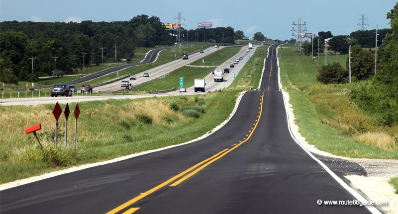
The original route is fairly well preserved, maintained and still practicable in 85% of its length (obtained by combining isolated, non-continuous segments); be it because it still works as an important communication means for locals on its path, or because the region benefits from the tourist craze the route persistently generates and choses to play with the Route-induced nostalgia.
Regardless, we should admit that Route 66 is difficult to follow, cut up in a multitude of successive sections since 1926, and today, interspersed with numerous Interstate stretches. Sometimes, it is nearly impassable. At other times, it ends in a cul-de-sac or is simply closed to all traffic on account of its decay.
Interestingly enough, these decommissioned sections become biking or walking trails occasionally featuring small monuments in honor of the Mother Road. We especially like that of Towanda, Illinois, where the nice walk on the road closed to traffic is flanked by scattered, small information poles on each of the eight states traversed. Many sights on and around the route are described, including the infamous "Dead Man's Curve", whose title speaks for itself ... (See "Route 66, a deadly road")
Tips to find your way on Route 66
Try to follow the railway tracks. Although this is by no means a bullet-proof method, Route 66 generally runs close to the railway track for a very simple reason: the route was already traced. Bear in mind that, in 1926, as the federal government endorses the highway system including Route 66, the center of the United States is still fairly hostile territory: rough weather, snow-capped mountain ranges, scorching deserts, lakes and tumultuous rivers. In following the railway track, Route 66's engineers saw a straightforward method to keep costs down. This explains why the Interstate network continues to follow Route 66 today on most stretches.
If you lack a very precise knowledge of Route 66 alignments, a generally valid approach is targeting the next town down the road. Chances are your GPS will suggest following Route 66 (you can also to identify an alternative to the Interstate using a map, without GPS support). On the other hand, you can also disable the Highway option on your GPS and force it to take secondary roads; in most cases, it will spontaneously take you to Route 66 (when available).
Signaling
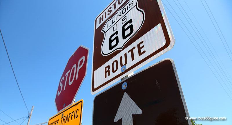
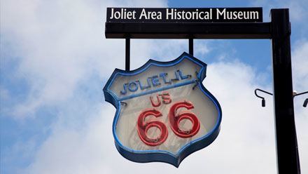
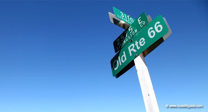
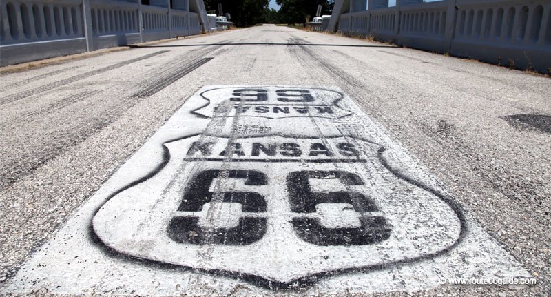
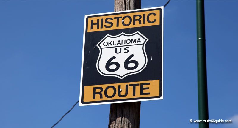
Today, the "succession of sections" which makes up Route 66 is classified as "Historic Route" and reported as such on the outskirts of the old tracks, on an usually brown "Historic Route 66" panel, in the same color as natural reserves or historical sites. Sometimes, Route 66 signs are directly painted on the road (prevents thefts).
The sections of Route 66
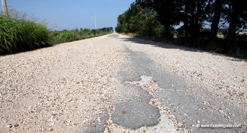
Without a map or travel guide, it will be a nearly impossible endeavor to intuitively follow the original Route 66, because its path has suffered major changes over the decades. As changes were introduced, the old alignments were simply abandoned as such and quickly overgrown by weeds and shrubs. Thus, we can cross ghostly sections of very early alignments laid down before 1925, whose ends are barred by Road ends signs. Sometimes, as in Narcissa Oklahoma, adventurous travelers can drive on the first transcontinental route alignment, dating back to 1922. Travelers beware, it's a bumpy ride!
Association's panels occasionally indicate the year in which the Route followed a particular alignment (1926-1930, 1930-1940, etc..) or more generically, whether it is an "old alignment", as opposed to a more contemporary one (from the 50s onwards).
We advise you to concentrate on the most recent alignments, veering off occasionally onto very early alignments for a few key sights. In fact, the last sections followed by Route are now better signaled and certainly more passable, while some segments of the oldest alignments are no longer paved or tarred and nearby attractions become extremely rare.